|
Geography as a field of inquiry........................5-10%
A. Major geographical concepts underlying the geographical perspective: location, space, scale, pattern, nature and society, regionalization, globalization, and gender issues. B. Key geographical skills
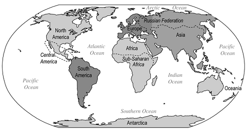
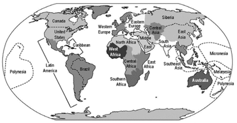
D. Sources of geographical information and ideas: the field, census data, online data, aerial photography, and satellite imagery E. Identification of major world regions |
|
kaplan: if you only learn 5 things in this unit...
- The Greeks were the first society to introduce geography as a subject. Eratosthenes is credited with being the first person to use the term geography, geo meaning "Earth" and graphy "to write."
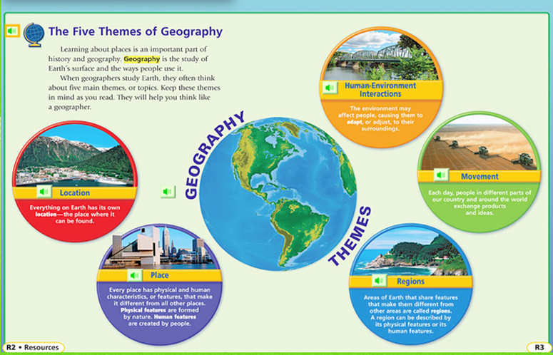
- The five themes of geography allow geographers to make each place unique (location) and link them together (region). Humans alter the environment to meet their needs (human-environment interaction).
- Diffusion is the spread or movement of a principle or phenomenon. Relocation, expansion, contagious, stimulus, and hierarchical diffusion are means by which an idea or phenomenon spreads.
- There are three types of regions: formal, functional, and perceptual or vernacular.
- There are three main aspects of distribution: density, concentration, and patterns. All are used to assist in determining spatial characteristics on the landscape.
chapter 1 reading notes and textbook powerpoints
|
| ||||
Unit 1 assignments
Ch 1 reading guide
|
unit 1 vocabulary list
| ||||
Print Map Handouts
Map analysis activity |
site situation assignmentTask:
You are going to show/explain the Site & Situation of 3 or 4 cities around the world using Google Earth/Maps/Images. You can compile your cites with the site and situation information on a word, google doc, etc. Create a new page or slide with the following information for each city. You must have 1 city per person in your group from around the world. For each city you must include: - an images that displays site or situation for your city - a minimum of 3 points about its site - a minimum of 3 points about its situation, - references of where you have obtained your information if using an outside source (url addresses etc) Assignments can be turned in through email, BlackBoard, sharing on google drive, or printing out a paper copy. | ||
Directions: Students select a map from a newspaper, magazine, the Internet, or another source. Students examine the map carefully and think about the choices the cartographer (mapmaker) made. This will be turned in. Students must answer the following questions on a separate piece of paper and turn in with their map:
- Why did the cartographer choose the color or colors used on the map?
- Why did the cartographer choose the particular symbols used on the map?
- Is there some form of data the cartographer chose to place on this map? If so, what is it? Why do you think she/he included the data?
- Do you find the map useful? What are some of the map’s advantages and limitations?
What are the Five themes of Geography?
|
how can you apply the themes of geography to PCHS? |
How does this map show perception?
unit 1 quiz material
1. Be able to ID thematic maps and know how each displays data.
2. ID map projections from the handout. Know where the greatest amount of distortion occurs on each.
3. Label lines of Latitude and Longitude. Know major lines such as Equator, Prime Meridian, etc
4. What else can lines of latitude and longitude show?
5. Answer questions based on the World Regions map. (Will have a copy on the quiz to use)
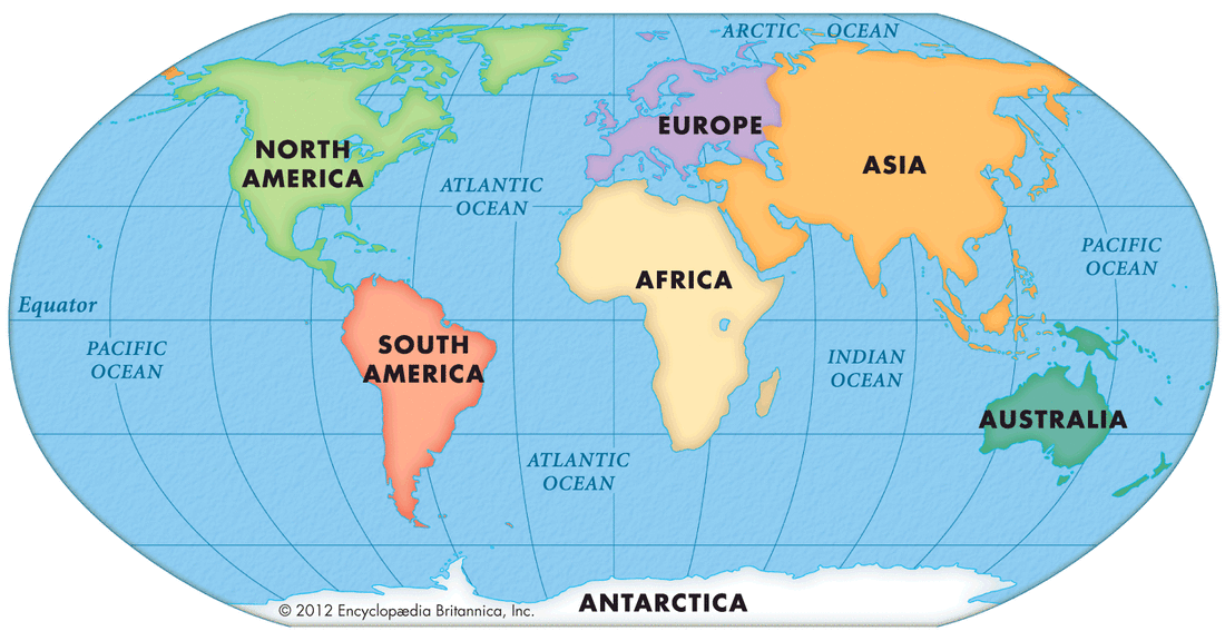
6. Label and ID the 7 continents and 5 major oceans
2. ID map projections from the handout. Know where the greatest amount of distortion occurs on each.
3. Label lines of Latitude and Longitude. Know major lines such as Equator, Prime Meridian, etc
4. What else can lines of latitude and longitude show?
5. Answer questions based on the World Regions map. (Will have a copy on the quiz to use)
6. Label and ID the 7 continents and 5 major oceans
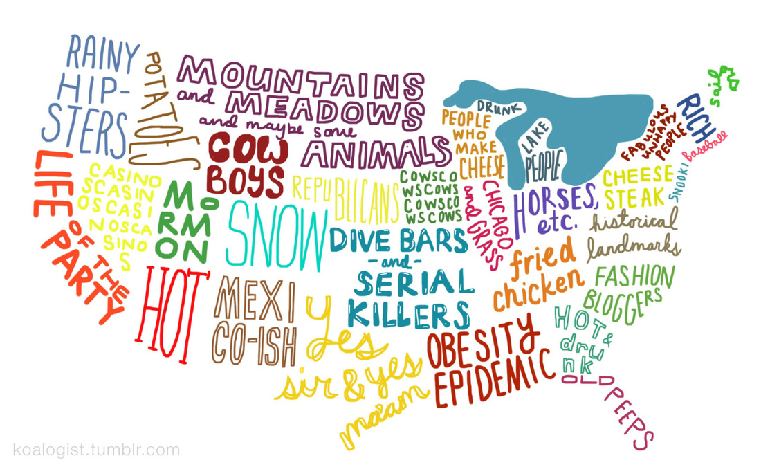
the world ACCORDING to you....
|
|
Possibilism vs. Environmental determinism
|
Assignment:
|
|
| |||
Unit 1 study guide and review
Review all Vocabulary for the Unit in addition to the questions below.
Themes of Geography
1. What are the five themes of geography? (Examples of each)
2. Explain the difference between sense of place and perception of place.
3. Identify Carl Sauer and concept of Cultural Landscape. Explain Sequent Occupance.
4. What is relative location? Absolute location? How do they differ?
5. The Rust belt is example of what type of Region? Why? What are the other regions?
6. How do humans alter the environment? What is sensitive environmental modification? Non-sensitive environmental modification?
Maps/Geographic Tools
1. What are the different projections? Which one is used most often? Which one shows the least amount of distortion?
2. Difference in Maps: Reference/Thematic. Identify Thematic Maps.
3. Where is the International Date Line?
5. Does latitude increase, decrease or remain the same as one moves away from the equator?
7. Where are the five oceans located in terms of latitude and longitude?
8. Who coined the term geography? What contributions do we have from early geographers?
9. Explain the difference between a pandemic and an epidemic.
10. Explain how geographers use different tools. (i.e. GIS, Remote Sensing)
Diffusion
1. What are the different types of diffusion? What has made a major effect on distance decay? What are the three types of Expansion Diffusion and examples for each? What effect does intervening opportunities/obstacles have on diffusion?
2. What are the three hearth’s of the diffusion of global culture and economy? Has globalization increase uneven development or decreased it? Why?
3. Define Culture. Cultural Complex.
4. What is glocalization? Why is it significant to globalization?
5. What is spatial Interaction? What effects/determines spatial interaction?
6. Explain and give examples of 3 components of Spatial distribution.
Geographic Concepts
1. Explain the difference between Environmental Determinism and Possiblism.
2. What is cultural ecology? Political ecology?
| |||
